


The Anti-Atlas mountains stretch across southern Morocco, the last mountain range before the Sahara Desert. It’s a stark landscape of imposing ochre granite mountains scoured by wind and sand, rocky soils scattered with argan trees and terraced slopes that once held fields of barley. It is the land of the Amazigh people, better known to Westerners as Berbers.

We (my husband Pete and friends Leslie and Diane) started our Morocco exploration in the Amellne Valley, a few kilometers from the small city of Tafraoute.

We were drawn to the possibilities of hiking and exploration for a few days and to the glowing descriptions of the inn we stayed in—Chez Amaliyah. The glowing descriptions were well deserved—we felt welcomed with comfort and the warmth of Moroccan hospitality.

For three days we walked Amazigh territory with our guide Ahmed. Ahmed, sun-burnished and wiry, was gracious, knowledgeable and patient and who seemed to enjoy a warm friendship with nearly everyone we encountered along the way. The early May weather was dry and warm and brilliantly sunny but not too hot yet for a day of walking.
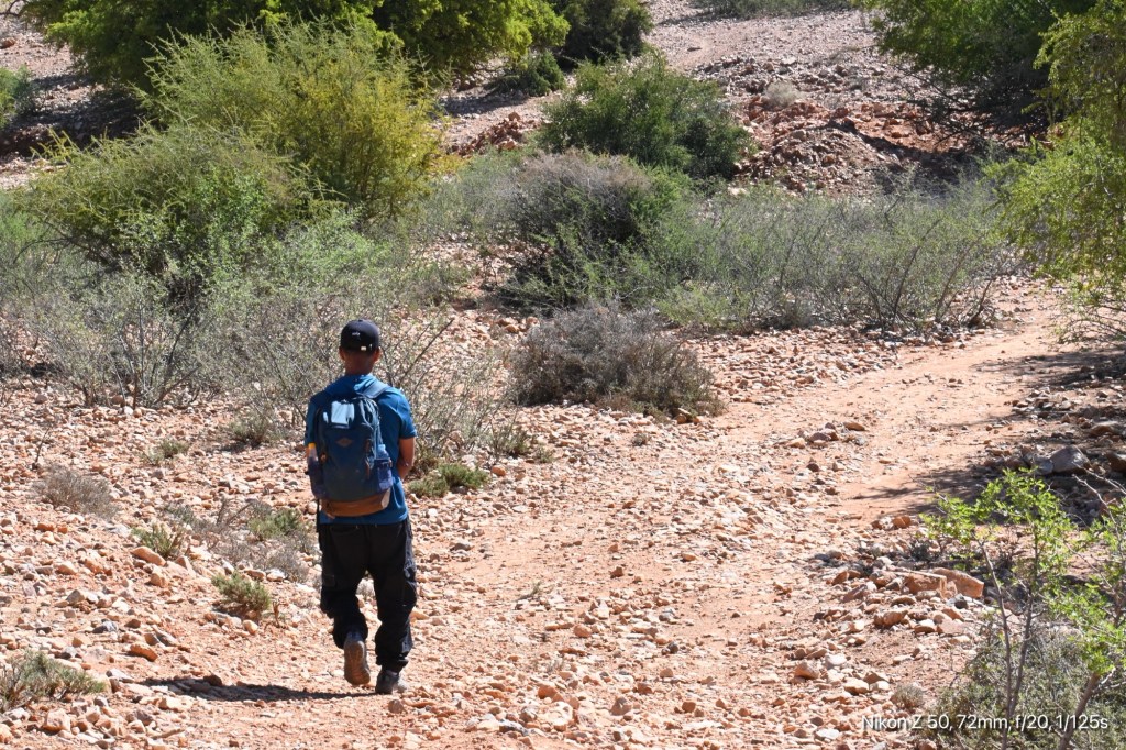
Our first day we attempted to hike to the summit of Jebel El Kest, the highest mountain in the Anti-Atlas. This climb is a fairly arduous and steep one over several miles of rocky trails and boulders. The summit proved to be too ambitious a goal for me. Although I am accustomed to the steep and rocky trails of the Adirondacks, I was still recovering from a hip replacement in February, and the sun and exertion slowed me to a halt. But I made it most of the way there — enough to take in the magnificent expanse beneath the mountains.

The Jebel El Kest climb begins from the village of Tagdichte, itself a drive up a steep white-knuckle hairpin road from the valley floor.

Just as the road becomes narrower and rougher, the white tower of the mosque and pink adobe homes come into view.
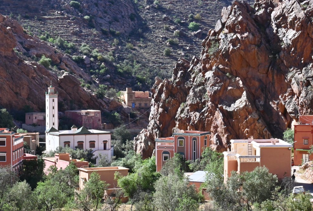
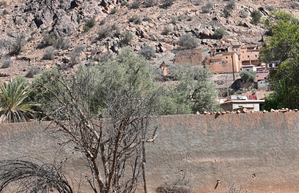
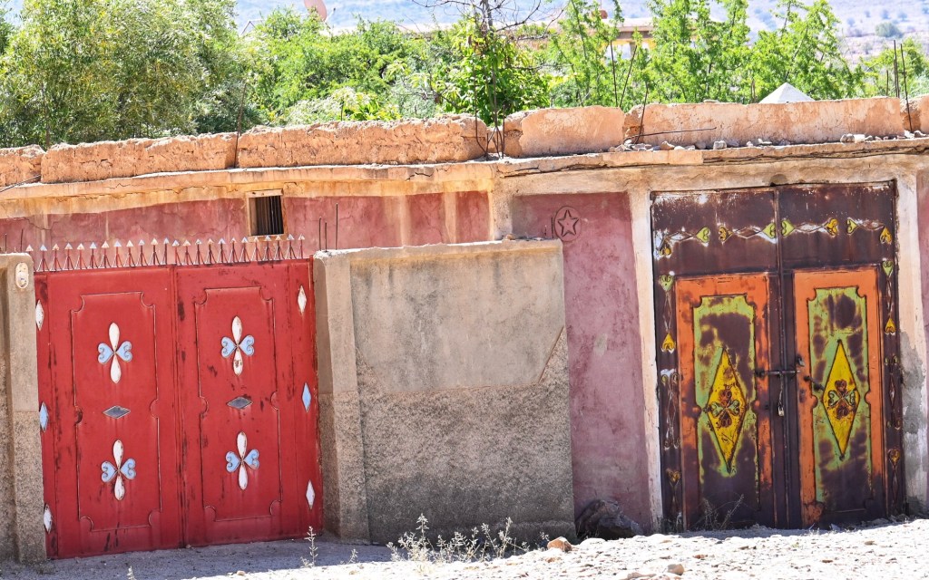
It is here that I begin to marvel at the ingenuity of indigenous people who for millennia have figured out how to live in land that to my untrained American eye seems harsh and unforgiving.

Here on rocky precipices, seemingly far from a source of water and building materials, was a village clinging to the cliff side.

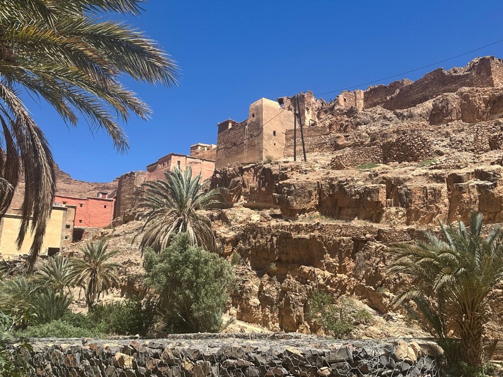
We would see villages like this over the next two days— ancient ones in ruins, and others where the ruins were interspersed with grand new residences, luxurious versions of traditional Amazigh homes.

Ahmed spoke often of the changing fortunes and demographics of these villages. Many have been all but emptied out by migration: to Casablanca or Rabat or to Bahrain or Dubai to work. But the ones who are lucky (or plucky) enough to make money [the “rich Berbers” as Ahmed kept calling them, not a “poor Berber” like himself] often build these grand houses in their ancestral village.

For some, the mansions will be for retirement, for some, they will be for the extended family to gather in the summers, or for festivals or rites of passage.
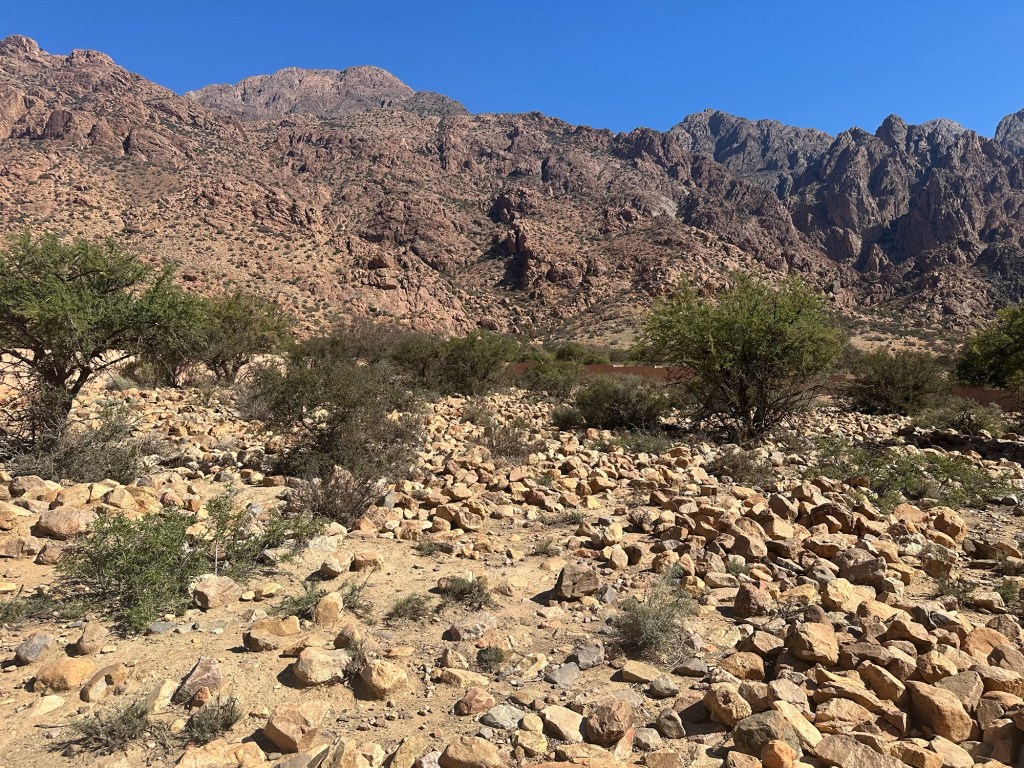
Drought has decimated the livelihood of some of these villages. Thousands and thousands of acres of land have been cultivated in meticulously constructed stone terraces that once help crops of barley and lentils and were now given over to weeds and erosion.


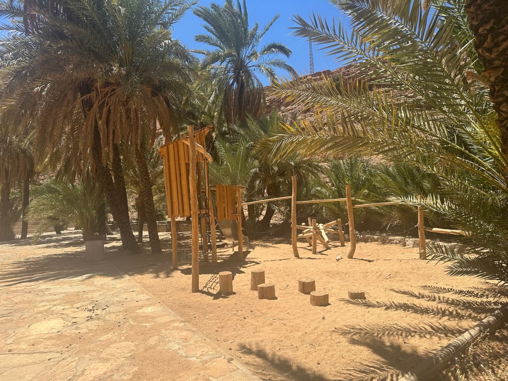
But then there are the astonishing surprises, like the oasis town of Ait Mansour.

You reach it after a long drive into the mountains, through canyons and gorges reminiscent of the American Southwest, into a narrow valley formed by a still-flowing stream. Oued Tamanart, a tributary of the longest river in Morocco, Oued Draa.

Ait Mansour feels settled and welcoming, with a couple of cafes and places to stay and even a spiffy new park and playground for the few children who must live there.
Again, the ingenuity of adaptation. A criss-crossing network of cisterns, sluices and small aqueducts keeps the valley irrigated.

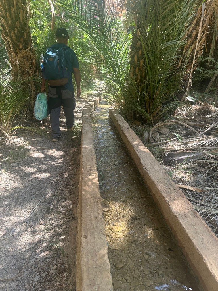
We walked for several miles through lush groves of date palms, pomegranate trees, fig trees, caper bushes, and trees bearing apricot, quince and the peach-like medlar.

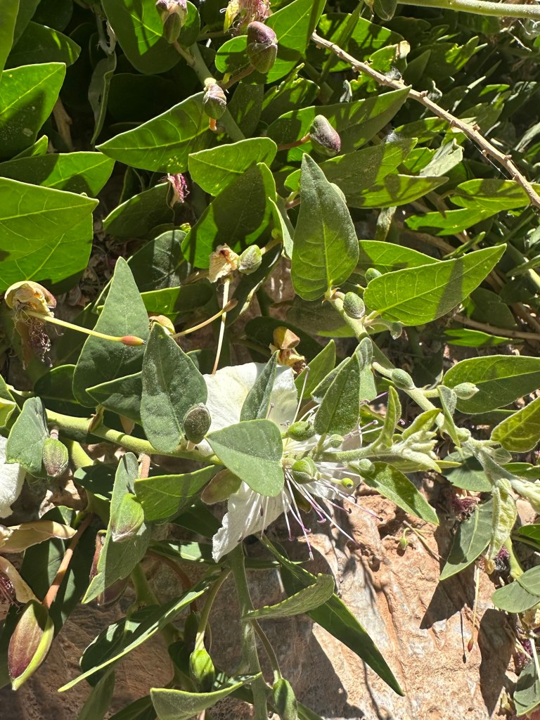
Everywhere in these mountains are the argon trees. Until I came here, what I knew of argon consisted of the bright blue-green bottles of Moroccanoil hair products. The twisted gnarled trees with bark like alligator skin are ubiquitous, dotting the endless rocky swathes of brown with bursts of green.
Like everything in this arid place, nothing in the argon tree goes to waste- the oil is extruded from the nuts, the nuts are dried or roasted, ground and eaten, the wood becomes lumber. The oil is used for cooking and cosmetics and ground with almonds to make amloul, a kind of almond butter-and countless other uses. The trees define the landscape much like cork trees in the Alentejo or Joshua trees in the California desert. It is good always to learn where things come from.

The ghosts of Jewish Berbers still inhabit this region. As we walked through the trees to the ancient village of Gdourt, Ahmed told us that Jews had once lived there. He mentioned the Jews of this region off and on throughout our three days. They were Berbers and part of the culture, even if of a different faith. They were known as silversmiths and traders.

But they are now all gone— to Israel and to the West. These were Jews who predated the Sephardic Jews who came after the expulsion from the Iberian Peninsula. Ahmed spoke of them simply as a people who had once been an integral part of the cultural fabric, but were now gone, like those Berbers who emigrate and never return.
On our third day of walking through the villages of the Ammelne Valley-Agasour, Tazoualt, Tandlit— we peered into a Jewish cemetery. Nothing now identifies it as Jewish. Inside were simply piles of rocks.
One might have thought the place had been vandalized, but Ahmed showed us other Muslim cemeteries where simple rocks mark the graves. So who knows? Elsewhere in Morocco are Jewish cemeteries with Hebrew still visible on headstones, but here, are just memories of neighbors.
After four nights at Chez Amaliyah, we headed north to the High Atlas, and then will journey on to Marrakech and Fes. There, I am sure I will see better preserved remnants of Moroccan Jewish life. But for now, I am grateful to have see this terrain, that is at once timeless and traditional, but like many places I have been, adapting and changing and most of all, welcoming to strangers like me.


fabulous pictures of an area that I remember so vividly. Enjoy that magical land!
LikeLike
You really bring the reader with you on your travels. Thank you!
LikeLike
Glad you liked it! Thanks for reading
LikeLike
Your travels and descriptions are delightful. This is a place I will probably never see (you are so brave and intrepid!). And I’m happy the hip worked out for you!
LikeLike
Gracias. Es fascinante. Y muchos lugares que no conocía.
LikeLike