

Trying to understand a huge, messy, sprawling city like Bangkok as a tourist is like being the proverbial blind man with the elephant- you might figure out an ear or the trunk, but you’ll never get the whole thing. And a elephant seems an apt metaphor— for elephant imagery is everywhere. This is about one unexpected piece of the elephant that fascinated me during my three days in Bangkok— the waterways.
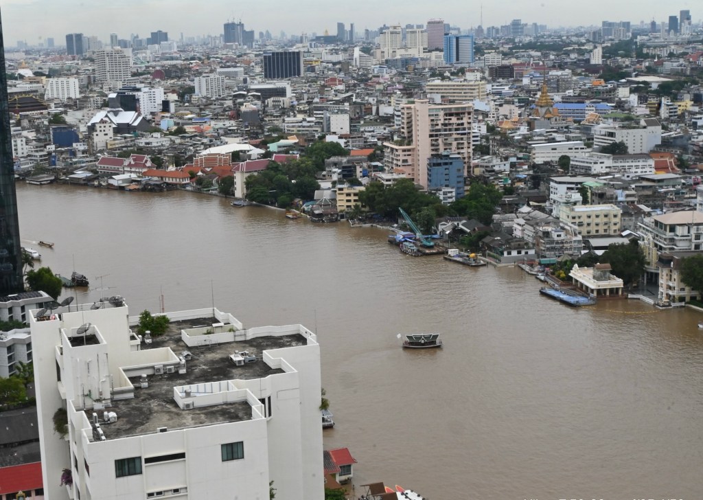
Pete and I set out to Thailand on our own, with little but hotels and a few day tours planned in advance. After reading about the dizzying array of Bangkok neighborhoods one could stay in, I opted for a hotel on the banks of the Chao Phraya River, imagining that the lull of the waterfront might provide a respite from a busy city. I was right about the respite. But what I hadn’t understood was the centrality of waterways to the historic city as transportation and livelihood—not just the wide muddy Chao Phraya, but the network of canals as well.
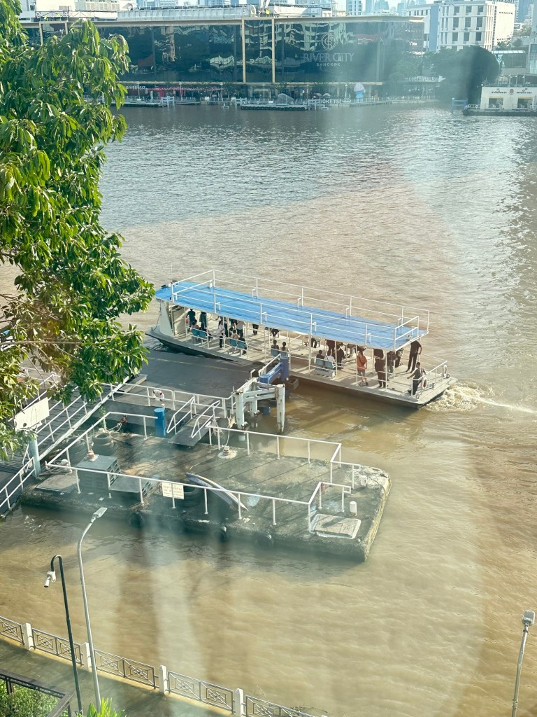
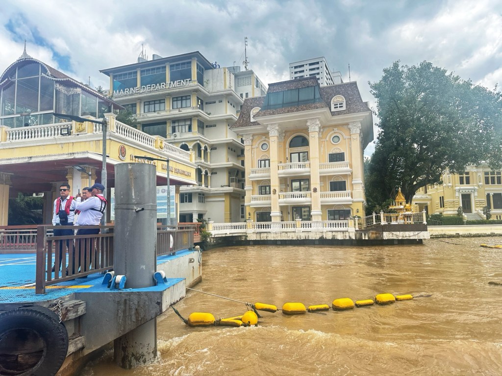
On our first day, we decided to see the Grand Palace and Wat Pho temple complexes, which are upriver from the hotel. This is when we learned that Google maps doesn’t tell you about the river boats, an off-the-algorithm commuter transport system, eclipsed by the car and the uber-modern Skytrain. The small ferries run up and and down the Chao Phraya, stopping at piers along the way. “Mind the gap” takes on new meaning as you must jump from the pier baffled with tires onto an old boat.
The 30-minute cruise up the river from the pier near our hotel to the Palace complex cost 40 baht for two (about $1.25). Maps of the pier stops and announcements in English make the voyage about as rational as taking the New York City subway system, but a million times more pleasant,with the breeze cooling your face on a warm day and smiling helpful people. When we disembarked at Wat Pho, we were ridiculously pleased with ourselves for having figured out how to travel by boat, though of course all we had done was stumble into something all Bangkokians know.
As seen from the water, the riverfront is a beguiling mix of glassy luxury hotels and vestiges of history. A naval building with an orderly stucco façade painted yellow, a ramshackle fisherman’s hut on a sinking pier. We would see the more vestiges of the 300-year history of a city inextricably linked to water over the next two days.
The following day we signed up for a five-hour “Boat and Bike tour” with Co Van Kessel Tours. From the pier, we hopped on a carved mahogany shuttle boat across the river to the tour office. Our group set off on bright yellow bikes, first winding our way through Chinatown. The markets and streets were ablaze in yellow and gold banners and streamers and flowers and altars—all to celebrate the annual Vegetarian Festival. This isn’t a foodie thing, but a spiritual time for the Thai Chinese Buddhist community during which they abstain from meat.

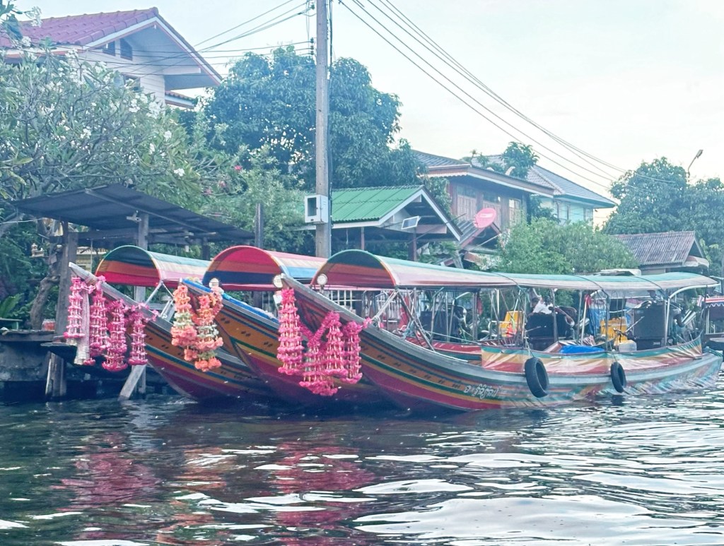
Crossing the river again by bike, we made our way to a “longtail boat”, painted in bright pink, red and yellow stripes, loaded up the bikes and began to make our way through the network of canals on the west side of the Chao Phraya river—far from the skyscrapers and shopping malls.
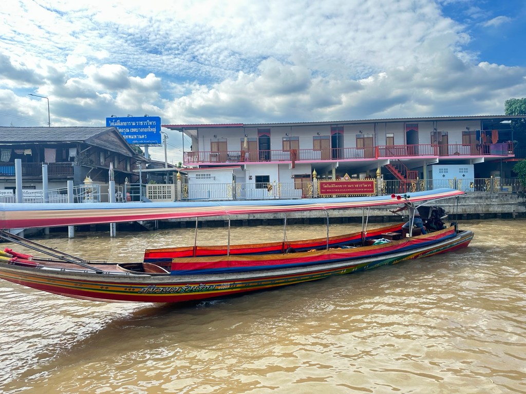
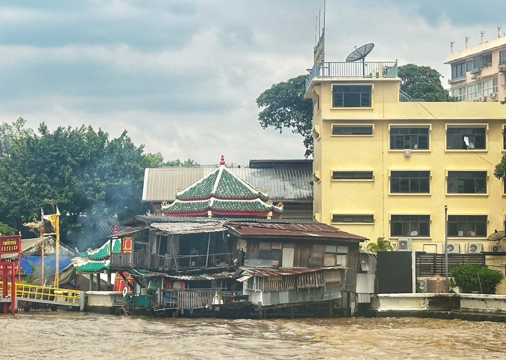
As we chugged through the canals, the landscape changed from busy and commercial to more quiet and residential. Wooden houses on stilts almost pour into the river, the boundaries between living inside and outside becoming more porous.
There were a few new, almost fancy, houses, perhaps belonging to more prosperous inhabitants who couldn’t give up their place by the water/ I thought of the boat tour I had taken in the Louisiana bayou— here as there, I sensed the unique culture of people who live over water (and during monsoon season, probably in water).


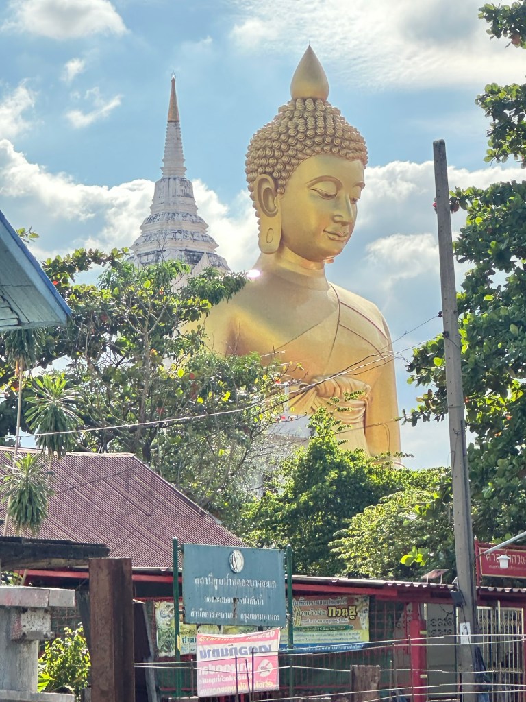
Temples and Buddhas, ubiquitous in Thailand, are visible from the canal boat.

Eventually we stopped, got back on our yellow bikes, navigating narrow paths and raised concrete passages through quiet, close-knit neighborhoods.

We stopped for lunch at Bahn Bahn The Local Restaurant before biking back to our longtail boat — this time to the end of the canal, through a lock, and then zooming down the Chao Phraya to the busy pier where we had started out. Although we had never left Bangkok, the neighborhoods along the canal seemed a century away.


The next day, we joined a street food tour with a company called A Chef’s Tour. The Thai, Vietnamese and Chinese food we crammed into three hours was wonderful but what I loved almost as much was that we walked and traveled around the city by old fashioned transportation— canal boat, creaky wooden-seated bus and tuk-tuk .

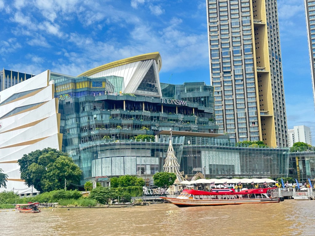
In this part of Bangkok the canals cut through neighborhoods of dense high-rises and elevated freeways. But the old canal boats persist, chugging along from pier to pier. And just as with the farther-out canals, a sliver of historic Bangkok survives along the fringes of the canals- ramshackle houses in the shadows of skyscrapers. It’s as if, even with the spasms of high-rise construction in downtown Bangkok, some spirit of the city said this zone of transportation past must survive.

After our food tour ended at the Nang Loeng Market, my husband and I headed over to the Jim Thompson House Museum, which sits near the edge of the Saen Saep canal.( It was a trip which taught me Bangkok Lesson #1 , which is never take a taxi in downtown; the mile and a half trip took an hour. Sitting in a stalled taxi breathing in exhaust fumes, I kicked myself wondering why I hadn’t gone back to the canal, which never gets traffic jams. Google maps does not tell you this).

Once in the Museum, the former home of the man who brought Thai silk to the world, I read about an ancient Cambodian Muslim community of silk weavers, the Ban Khrua, who had lived along this canal since the 18th century. Many of the weavers still live there, a footbridge across the canal to the Thompson house. I’ve since learned that the Ban Khrua people have been fighting to save their community from the encroachment of development, staving off a freeway that would have destroyed the neighborhood. I imagine that the canal remains an artery, not just for daily movement, but as a lifeblood. I read here that the royal chronicles of the time the canal was dug record that King Rama I wanted a canal “so that the city people could assemble, in boats, to perform music and to recite poetry as in the rainy season ceremony of the old capital, Ayutthaya”. What better use for a waterway than to bring people together for art?

Truly amazing, thank you for the wonderful tour of delight and mystery. Beautifully described and clearly enjoyed by you (and now me). Fascinating place, how a city grows around its natural features. King Rama I had it right.
LikeLike
Thanks for reading Nancy!
LikeLike
Love the narrative! I’m enjoying traveling along with you, and seeing the sights of Bangkok.
LikeLike
Thanks for reading!
LikeLike
it is great reading and seeing images of your amazing trip!
LikeLike
Thanks for reading!
LikeLike
¡Muchísimas gracias, Sharon, por el interesante relato de viajes sobre transporte! voy a regresar a el si jamas voy a Bangkok…. mi encantan los medios de transporte publicos cuando estoy
LikeLike